Tanzania -3.25°S / 36.75°E. If you’re looking for a shorter, less visited, cheaper alternative to Kilimanjaro, look no further than Mount Meru. A dormant volcano, it’s a 3 day hike to the 4,565m (14,980ft) summit. Comfortable cabin accommodation awaits you en-route as you climb up from the hot savannas through lush cloud forests. Eventually you’ll traverse the dramatic frost-covered caldera wall to reach the summit, where you’ll be greeted by phenomenal views over Kilimanjaro and the surrounding plains. Read on for travel tips and volcanic facts!
Published August 20th 2025 by Josef Clifford.
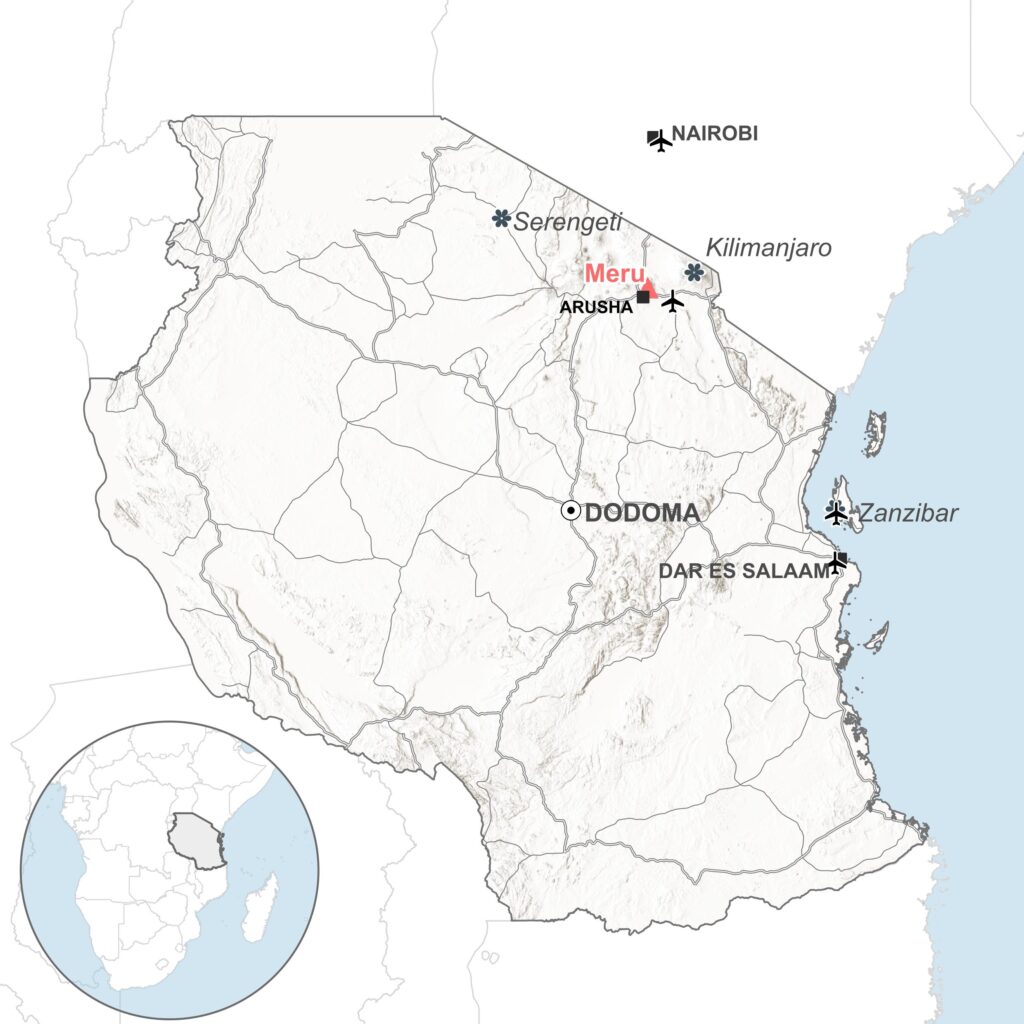
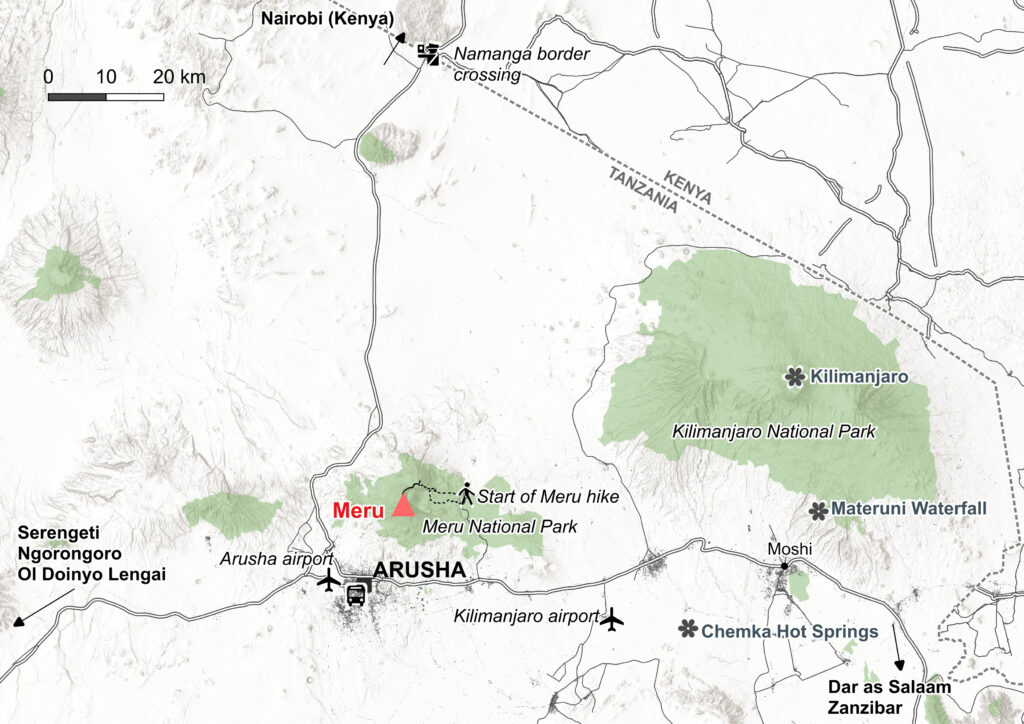
Getting there: Arusha is the closest city to Meru and a tourist hub for the entire region. Like me, it will probably be your arrival point. If you’re already in the region, Busbud is a useful site to find bus tickets.
Tours: Most people go on a tour – I went with Signature Safari – book on Tripadvisor here. The guides are patient and knowledgeable, they’re well organised, and they hire out equipment too.
Where to stay: I stayed in a lovely little AirBnB in Arusha. For hotels, check Tripadvisor. More details in the Practicalities section.
Safety: Meru has a history of largescale explosive eruptions as well as minor lava flows and ash eruptions. Although currently dormant, future eruptions may occur and it’s still wise to check latest activity reports! Also be aware of altitude sickness. Meru’s summit is over 4,500m. Take it slow and drink plenty of water. If you’re worried, you can take acetazolamide as a precaution.
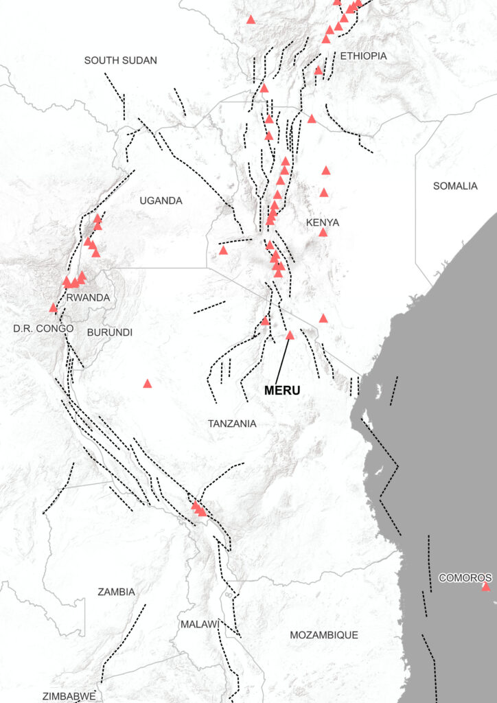
Northern Tanzania’s landscape is shaped by the East African Rift Valley. A result of the ongoing divergence of tectonic plates, it’s an interconnected lattice of mountains, elongated valleys and faults. It’s also a hotspot for seismic and volcanic activity. Just 70km from Kilimanjaro, Meru, like its larger sibling, rises dramatically above the relatively flat savanna below, straddling the eastern boundary of the rift system.
The whole area is full of natural wonders, rich in culture, and home to lovely people. You could spend weeks exploring.
Jambo, as you’ll often hear in Tanzania (meaning “hello” in Swahili) – and enjoy the blog!
Jump to a section
> Arrival in Arusha
> To the Saddle Hut and Little Meru
> The climb to the summit
> Volcanology section
> Practicalities & more to see in Tanzania
Jambo Arusha
I was working in Nairobi at the time and with a week off approaching, I decided to meet up with a friend in northern Tanzania. Whilst we’d also be visiting the Serengeti and Ngorongoro, as a volcano lover, the prospect of visiting Mount Meru was a big draw for me. Ngorongoro, being an ancient volcanic caldera filled with wild animals, sounded pretty cool too.
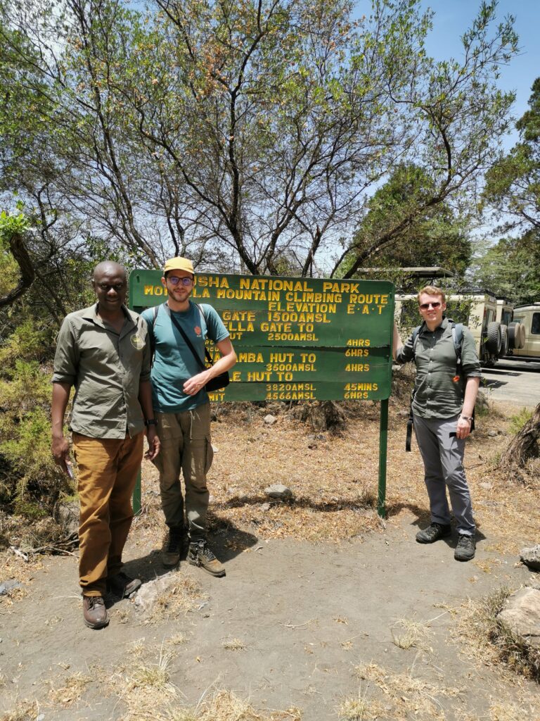
It was a short five hour hop via shuttle bus from Nairobi to Arusha (check Busbud for bus options). Arusha is a large bustling city in the shadow of Mount Meru. It’s also a diplomatic hub and was host to the international criminal tribunal for the Rwandan genocide. Also known as the Safari Capital, Arusha’s main draw for tourists is its proximity to an array of stunning natural landscapes. The Serengeti, Kilimanjaro and of course Mount Meru aren’t too far away.
It’s easiest to go on a tour. I went with Signature Safari. See the dedicated section for more details. The day before the start of our tour to Meru, we met the guides in a cafe in Arusha (Fifi’s Restaurant to be precise – a great place to try local favourites like ugali, tilapia, bean stew and more as a matter of fact). They outlined the itinerary, handed over the equipment we’d hired (we were travelling light so didn’t have hiking gear on us) and explained what else we’d need to bring.
Through the savanna
The following morning, our guides picked us up from the hotel early. It was a short drive through the beautiful savannas of Arusha National Park, which were dotted with zebras, giraffes and buffalos. After an hour or so, we reached the park office and the starting point of the Momella route to Meru’s summit. The wait here turned out to be a little longer than anticipated – time moves a little bit slower in Tanzania.
There was a little kiosk where we could stock up on last minute snacks and get one last cold drink. We met up with the rest of our group, just two Dutch girls. In fact the four of us were the only climbers today. Nothing compared to the 140-235 that start a climb on Kilimanjaro each day.
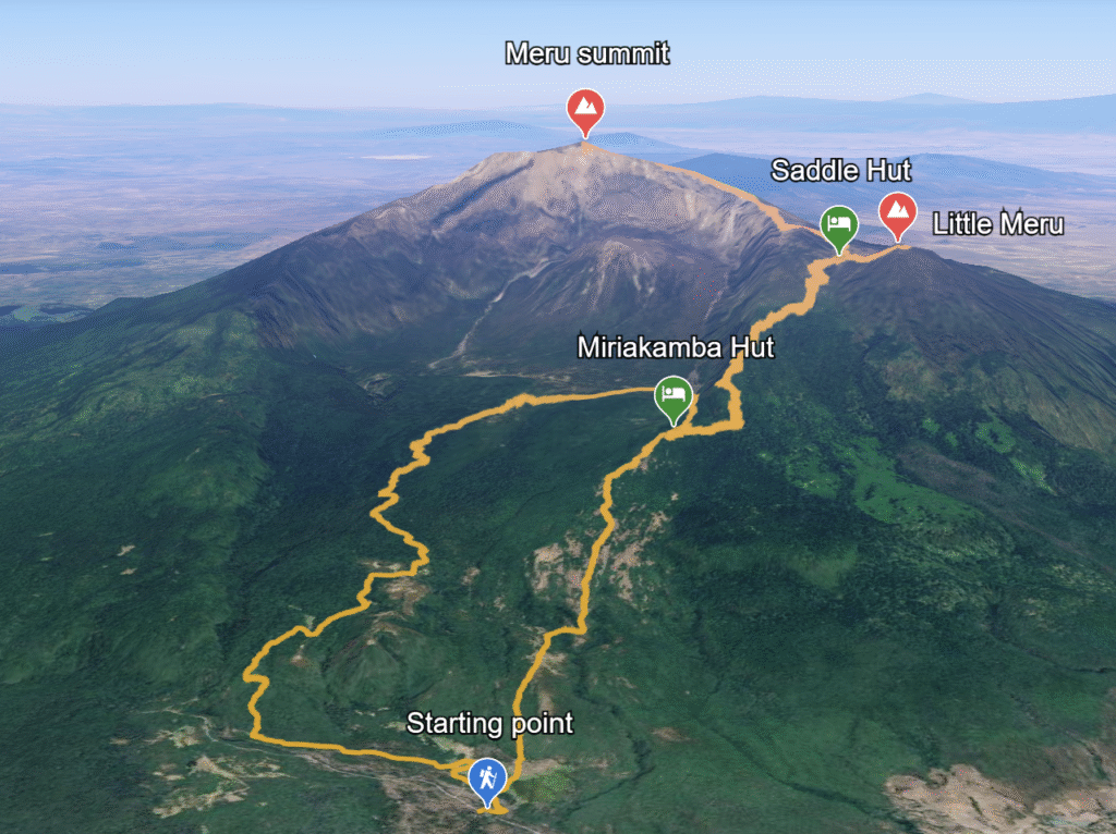
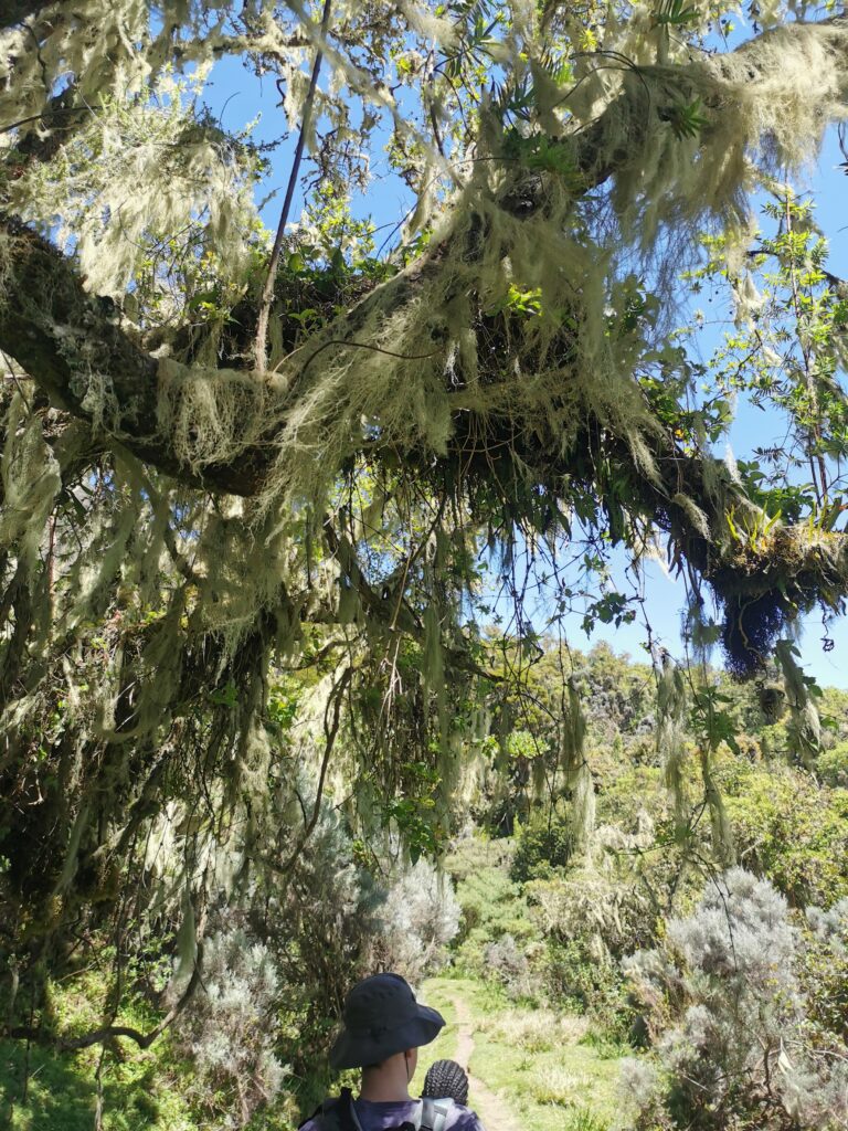
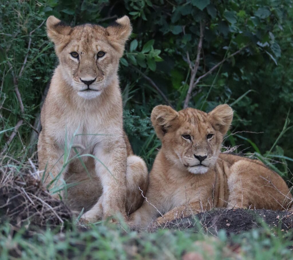
The trail winded up from the 1580m (5200 ft) starting point through dense montane rainforest. We saw black and white colobus monkeys swinging between the branches and warthogs and bushbucks quietly grazing.
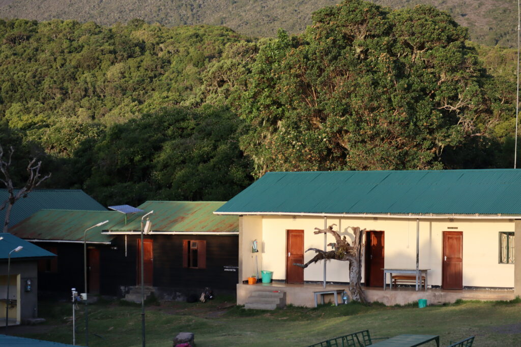
We soon reached the famous Fig Tree Arch, where we stopped for lunch. Onwards it became quite steep to the first camp, Miriakamba Hut (2465 m, 8097 ft). However, a relatively easy day to warm up with. Don’t expect luxury but the cabins were pretty comfortable considering we were half way up a Tanzanian volcano. Cold showers but plenty of food to prepare us for the next day.

Into the saddle
After a big breakfast on the second day, we hiked up through misty cloud forests covered in lichen and moss. Ascending above the tree line, we headed into the heathland and finally to the second cabin, Saddle Hut (3560 m, 11686 ft), so named because it lies in the valley between Meru and Little Meru.
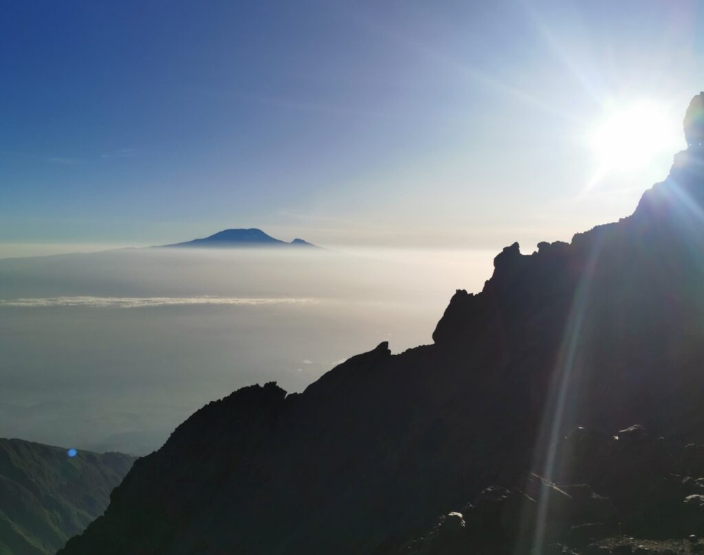
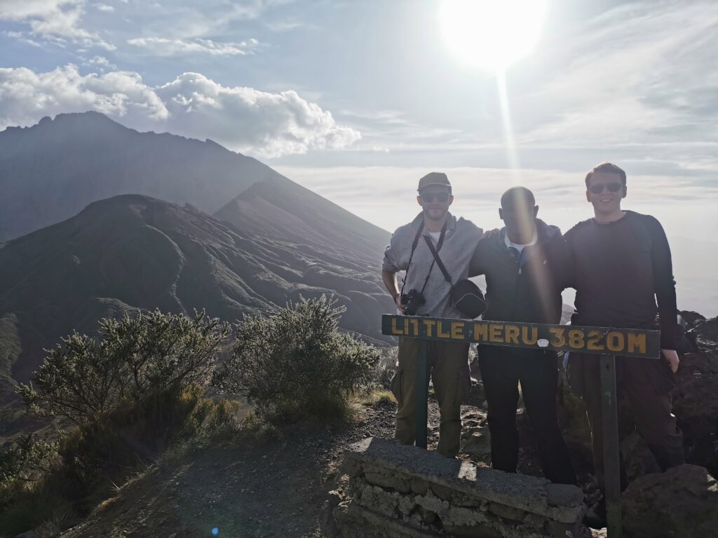
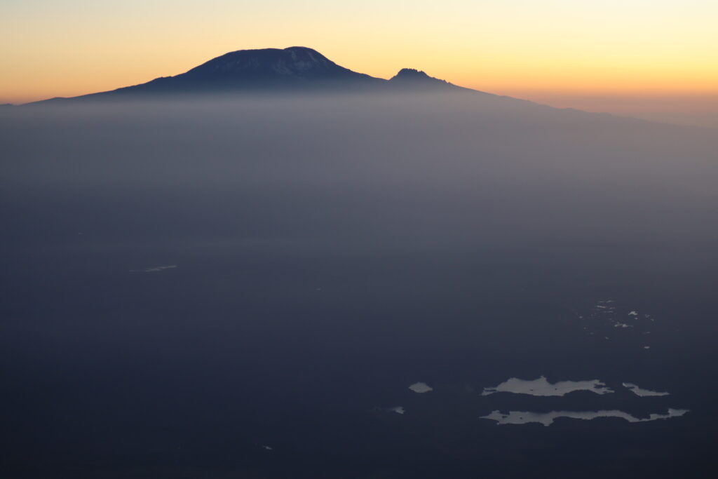
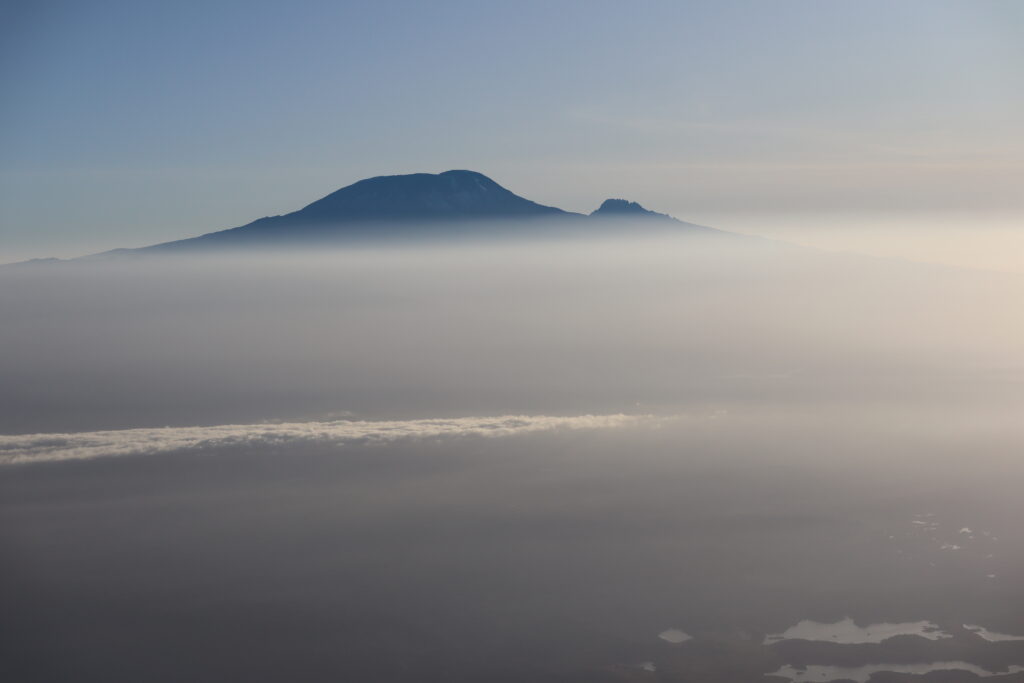
There were spectacular views from here across to Kilimanjaro, 70km to the northeast. After a little rest, we hiked up to Little Meru (3,801 m, 12470 ft). It was a steep but relatively short climb. It’s a good way to help acclimatise to the high altitude, which you might start feeling a bit now.
Slowly, slowly to the summit
When we returned to the camp, we had dinner, packed for the summit and got a couple of hours sleep before a wake-up call at the ungodly hour of midnight. Backpacks on, headtorches fitted, we started the final ascent to the summit. It was still a long way to go.
Pole pole, meaning “slowly, slowly” in Swahili, were the key words that our guides kept repeating. It certainly is good advice so you don’t overexert yourself and to help acclimatise to the high altitude.
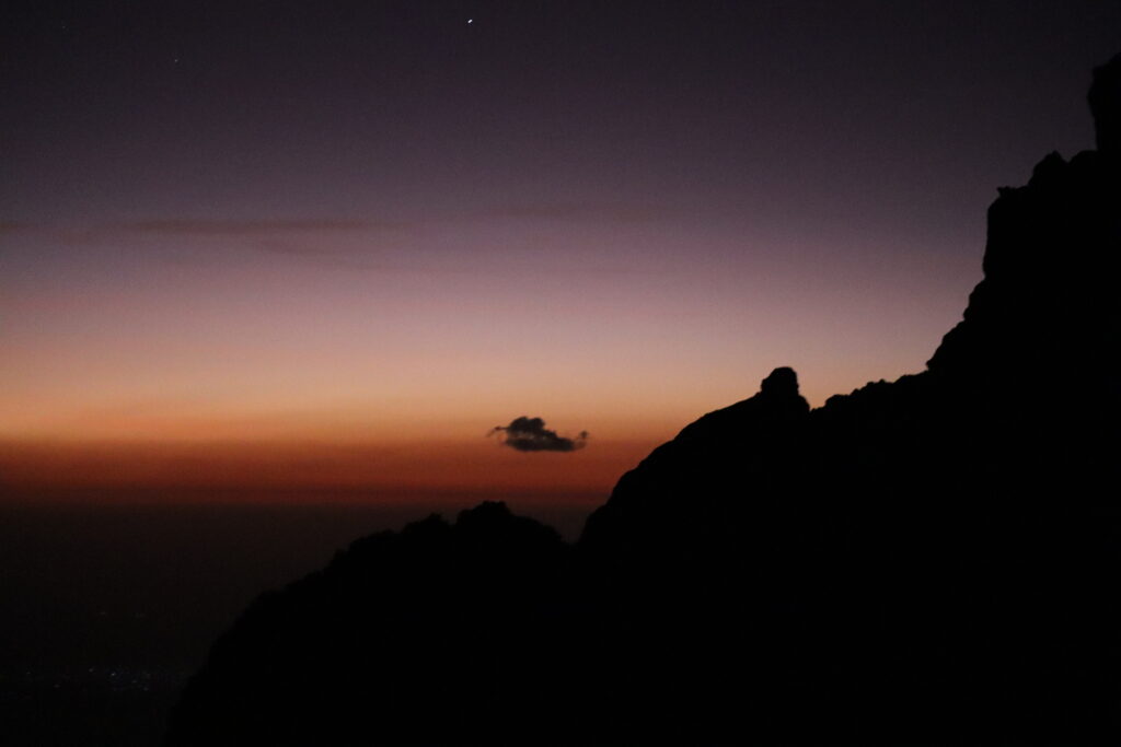
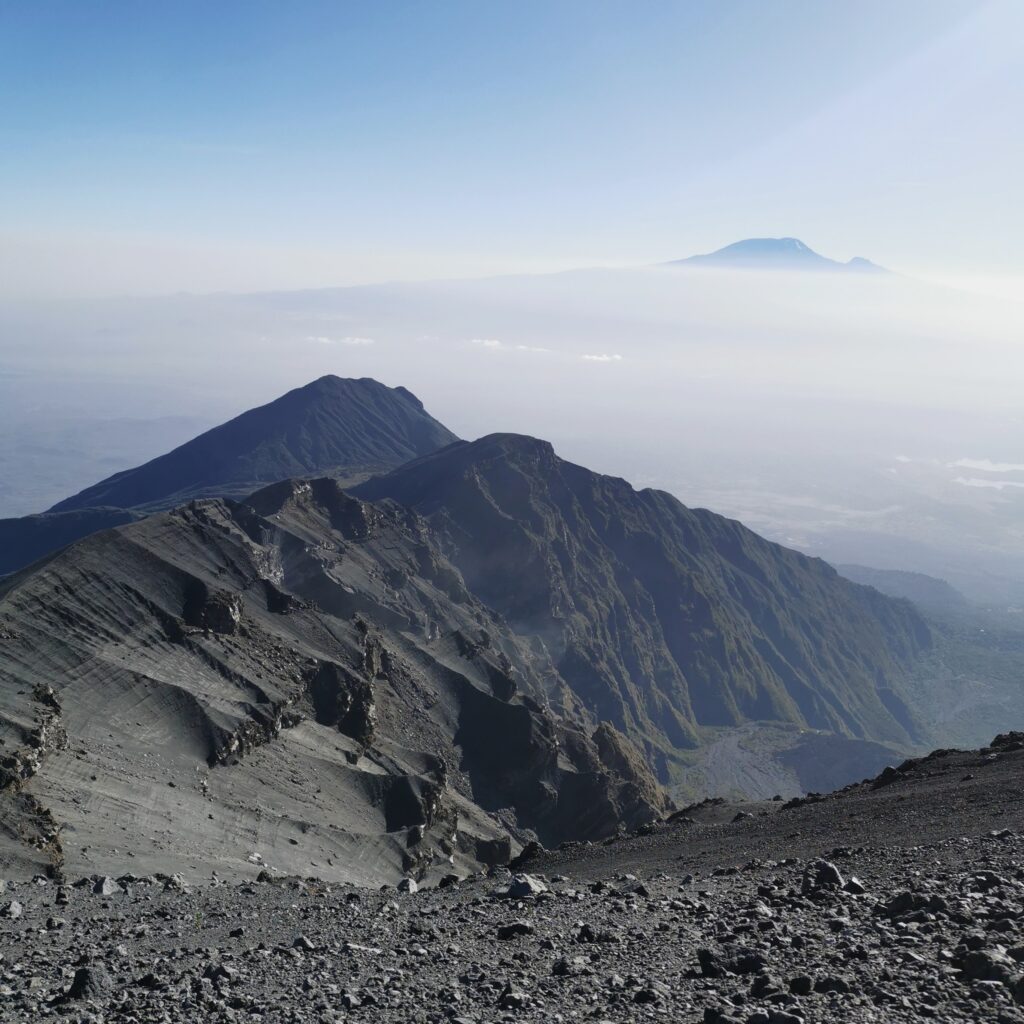
We climbed up a steep path onto the boulder-strewn lifeless ridge of the caldera wall. Narrow at times, with sheer drops on either side, we were forced to traverse rockfaces clinging on to ropes. The bright lights of Arusha lay far below with clear starry skies above. If you don’t like heights, you’re not going to love this bit.
The cold was biting near the top, with a light covering of frost. In the rainy season, it’s not unusual to find snow here. I was grateful for the down jacket and warm gloves we’d borrowed which finally came in handy. The altitude was creeping up on me by the time we reached the final stretch. I was almost crawling over the final boulders but I was determined to reach the summit.
Sunrise over Kilimanjaro
Gradually the morning light illuminated the landscape. We made it to the summit (4,565m, 14980 ft) just in time for sunrise. The sun rose right behind Kilimanjaro, it’s peak sticking through a thick layer of cloud. On the other side, the volcano cast a vast shadow across the flat plains. The views were absolutely phenomenal and it was completely worth the difficult climb.
You may hear some people refer to Meru’s main peak by its historic name Socialist Peak, an echo back to Tanzania’s socialist ideology during the presidency of Julius Nyerere in the 1960s.
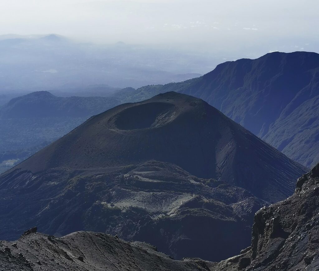
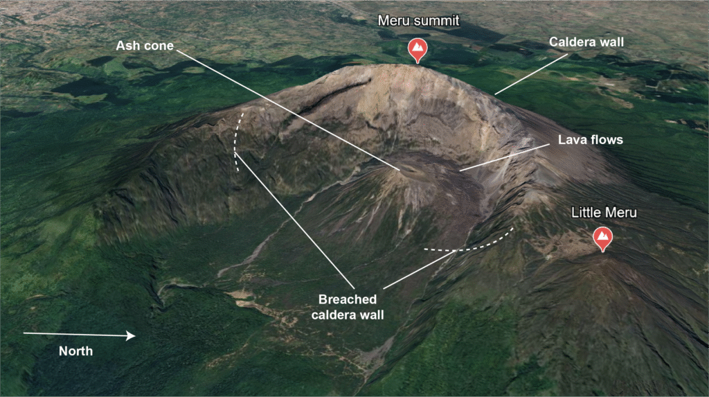
During the descent, there were stunning views over the caldera, lava flows and Ash Cone which had been hidden in the darkness during the ascent. It felt like a very long way down and without the end goal of the summit, it was quite a struggle. Just persevere through this bit though and you’ll get there eventually!
I felt weak and my knees were so shaky I thought I would collapse by the time I returned to the cabin. After lunch and a little relax here, it was onwards and downwards, all the way to the bottom. Well, we cheated a bit as we got a jeep taxi from the lower camp back to base. But I think we’d earned that.
A sleeping volcano (for now)
Meru is one of six volcanoes1 within Tanzania’s portion of the East African Rift System, an active divergent tectonic plate boundary. The Nubian plate to the west of the system is ripping apart from the Somali plate to the east, causing the African continent to split into two.
“Ripping apart” might sound a bit dramatic when it actually works out at just ~6-7mm/year. However, on geological timescales the rift will continue to sink and ocean waters will eventually flood the basin.2 But you won’t need your swimming stuff unless you’re reading this in a few million years from now.
Running 3500km from the Red Sea to Mozambique, the rift system actually includes an eastern and western branch. Meru sits on the more volcanically active eastern branch, whilst the western branch, which runs from Uganda to Malawi, is known to experience more earthquakes.
The rift system most likely developed due to elevated heat flow in the upper mantle beneath Ethiopia and Kenya around 25 million years ago. This would have caused uplift and fracturing in the Earth’s crust, leading to outpourings of vast quantities of basalt lava known as flood basalts. A system of extensional (normal) faults would have developed, eventually creating the landscape of the rift system we see today, with its steep elongated valleys and highlands.3
Although the volcano is classified as dormant, there have been occasional eruptions in the last couple of centuries. This includes effusive activity, like the most recent small ash eruption from Meru’s ash cone in 1910. However, evidence indicates the odd bout of significant explosive activity, characterised by Plinian eruptions and pyroclastic flows.4
The last major eruption was almost 8000 years ago around 5850 BC. This eruption reached 4 on the Volcanic Explosivity Index (VEI),5 which is something like the eruptions at Eyjafjallajökull in Iceland in 2010. If you’re from western Europe you might remember the massive flight disruptions caused by the massive ejections of ash from the volcano.
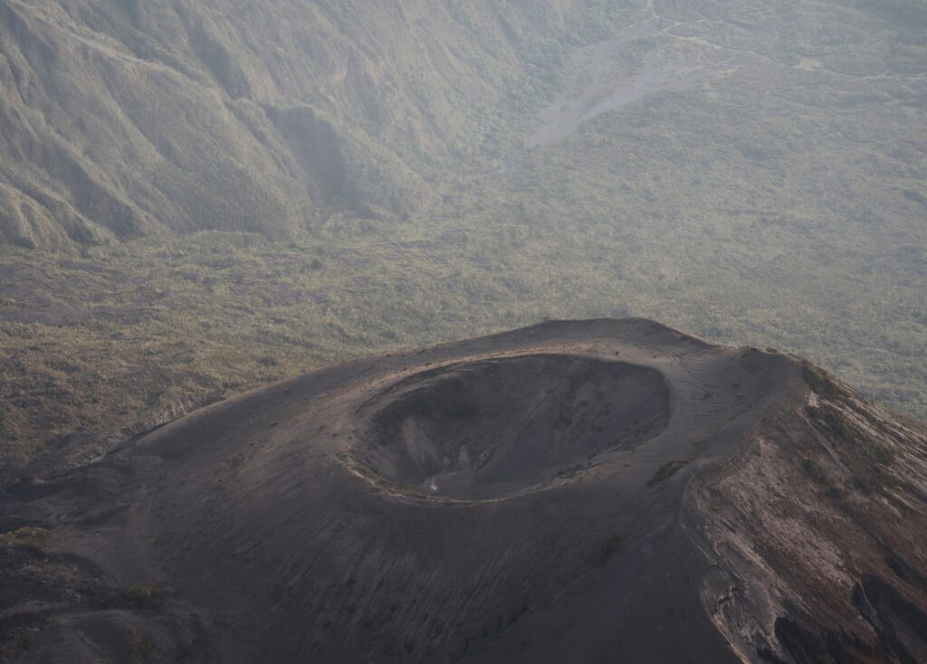
The 5km-wide breached caldera that is a defining feature of Meru today was caused by the 5850 BC eruption. The main route to the summit of Meru is named after this eruption, which is known as the Momella event, as the trail follow the walls of the breached caldera.
The eruption also resulted in lahars and some of the largest debris avalanches seen anywhere in the world, which travelled as far as the western flanks of Kilimanjaro.6 The historically active symmetrical Ash Cone forms another prominent sight within the breached caldera, whilst a second vent between it and the caldera wall has fed lava flows that cover much of the caldera floor.
As mentioned, Meru may be sleeping but it’s by no means taken it last breath. There’s a long history of largescale Plinian eruptions and similar future activity can’t be ruled out. As of 2014, monitoring was limited, meaning that a state of unrest could go under the radar and the potential for future eruptions underreported.7 With a large population surrounding the volcano, including the city of Arusha, enhanced monitoring will be vital in future.
Practicalities
Arusha is the closest city to Mount Meru and you’ll almost certainly pass through here. You can arrange tours from here and there’s a range of comfortable accommodation options. In Arusha, we stayed at a lovely 2-bed AirBnB located in a suburb south of the centre. However, there was a small shopping centre nearby and it’s only a short taxi ride into the city centre.
Personally I prefer to travel overland when I can; not only is it more environmentally friendly, but it’s usually a more interesting experience. If you’re short on time, Arusha airport (8km from the city centre) is served by domestic destinations like Dar es Salaam and Zanzibar, as well as Nairobi.
For international flights, your best bets are Kilimanjaro Airport (52km from Arusha), which has some direct flights to Europe and the Middle East, or Nairobi JKIA (260km from Arusha), which is a major hub with direct flights to destinations across Africa, Europe, Asia and even New York.
If you are already in East Africa, you can reach Arusha from Nairobi on the daily shuttle bus ($25 each way). I went with Regional Luxury Shuttle and Tours. Shuttles arrive and depart from a small depot off Simeon Road near the Mezaluna Hotel, but check with your company for the exact location.
You can also of course take a bus from other cities in Tanzania such as Dar es Salaam. The main bus station is located here. Note high-end bus companies may have their own bus stations. Make sure to buy your ticket in advance and be clear on the departure location. Check Busbud for bus options.
Tours: we went with Signature Safari. You can find the tour on Tripadvisor here. They were very well organised and the guides were really friendly and supportive, so I’d definitely recommend them. You can also hire equipment from them if you need, including sleeping bags (which you’ll need in the cabins) and warm clothes (which are essential for the final ascent to the summit, plus nights at the cabins can get quite chilly).
Tanzania’s not a cheap country for tourists and this tour set us back $670 each (in February 2023). However, it’s still a lot cheaper than Kilimanjaro. That was for the 3 day/2 night tour. With the 4 day/3 night tour, the only difference is that you get an extra night at the lower camp after summiting. However, we still had to walk to this point on our tour and took a Jeep back from there anyway.
Visas: don’t forget to get your visa for Tanzania before travelling if you need one (you’ll find a list of exempt countries here which includes many African and island countries, but most nationalities will need one). You can apply for an evisa here, or some nationalities can obtain a visa on arrival – check here. Make sure to have all your documentation in order.
When to go: the best times to climb Mount Meru are in the short dry season between December and early March or during the long dry season between June and October. The skies should be clearer during these times, meaning better views of the mountain and nearby Kilimanjaro. Note it can be a bit colder during the long dry season.
We went in early February and the weather was perfect – no rain, mostly clear-ish skies (some clouds actually enhance the views in my opinion) and not too cold, except at the very top. It’s possible to climb during the rainy season but beware it may be wet, cold and muddy, and you may not see much.
Language: Over 120 languages and dialects are spoken across Tanzania, whilst Swahili is spoken by over 90% of the population. Although English is widely spoken in tourist areas and cities, knowing a few words of Swahili will always go down well.
Extend your trip: Tanzania is home to fascinating cultures and is full of stunning landscapes. Here are some other places you could visit on your trip:
Kilimanjaro: many people climb Meru as a warm-up for Kilimanjaro given the shorter duration and lower altitude (although Meru is actually often considered more difficult as it is stepper and has a more rapid altitude increase).
Chemka hot springs and Materuni waterfall: there are a number of hot springs and waterfalls nearby. You can visit them on a tour; we visited these ones with Signature Safari for $100 (in February 2023), which also included a visit to a coffee farm.
Ol Doinyo Lengai: I really wanted to go here but my friend was already volcanoed out. The name means Mountian of God in Massai language and it’s a very impressive steep-sided volcano, unique in the world for its low temperature carbonatitic lava.
Ngorongoro Crater: a stunning ancient volcanic crater formed by the collapse of a massive volcano 2.5 million years ago, its flat floor is inhabited by the Big 5 and a tonne more wildlife and bird species. Usually visited as part of a Serengeti tour.
Serengeti: probably one of the most famous national parks in Africa, you’re guaranteed to be blown away by the wildlife that inhabits this vast savanna.
Zanzibar: these well known islands are on most people’s bucket list when they visit Tanzania. You can easily visit them by ferry from Dar As Salaam. If you’ve got more time and when the security situation improves, the Quirimbas Islands in northern Mozambique are similarly stunning and you’ll find far less tourists (I visited in 2019 when it was safer).
- Tanzania is home to six Holocene volcanoes, i.e. volcanoes that have erupted during the Holocene period, which approximately covers the past 12,000 years. There are many more volcanoes which are considered inactive. ↩︎
- The Geological Society. ↩︎
- The Geological Society. ↩︎
- The late Quaternary eruptive history of Meru volcano, northern Tanzania. ↩︎
- Smithsonian Institution. ↩︎
- BGS, Volcanic Hazards in Tanzania. ↩︎
- BGS, Volcanic hazards in Tanzania. ↩︎
Discover more from magmachambertravel.com
Subscribe to get the latest posts sent to your email.